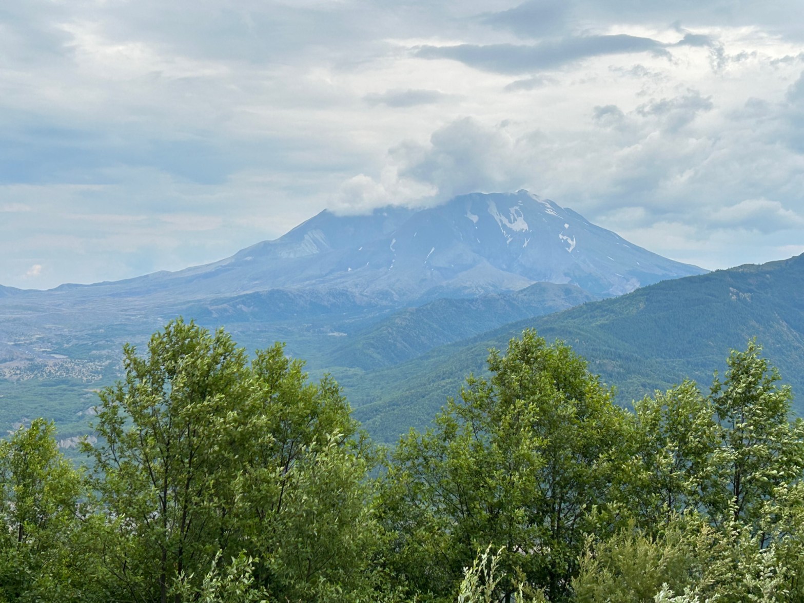
On the morning of May 18, 1980 a magnitude 5.1 earthquake triggered one of the world’s largest recorded landslides as the north face of Mt St. Helens collapsed to bury the valleys below, followed within seconds by one of the most powerful volcanic blasts in the history of North America. Within ten minutes the eruption cloud reached a height of twelve miles. 57 people lost their lives on that fateful day. Come learn the fascinating story of Mt St. Helens, the eruption, the human cost, and the period of recovery that followed.
You may want to print this itinerary as internet service is spotty or unavailable in some areas.
Best time to visit: you will absolutely want to include the Forest Learning Center in your visit, which limits a visit to mid-May through September.
Time management: drive time alone from I-5 to the Mt St. Helens Science and Learning Center will be 45 minutes (55 minutes to Johnston Ridge Observatory, once it reopens). The day’s itinerary must be complete by 4:00 p.m. when the Science and Learning Center, or the observatory, closes; an estimated total of five hours for visiting the various sites suggests that you should arrive at the Mt St. Helens Interpretive Center by 10:00 a.m.
Washington Parks Mt St. Helens Interpretive Center
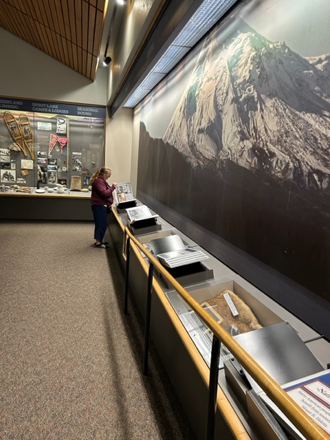
This spacious and beautiful building houses a top-notch visitor center positioned at the gateway to Mt St. Helens National Volcanic Monument on the Spirit Lake Hwy. Come learn about the landscape and its geology and the history of eruptions at Mt St. Helens and even how these eruptions compare to other significant volcanic eruptions in Earth’s history. Learn about the day-to-day developments that began in March 1980 that led up to the May 18 eruption and how it impacted the local peoples and ecosystems and the subsequent recovery and regrowth.

Plan 1.5 hours for your visit, which includes a 23-minute movie in the theatre, though you may need a little more time if you walk the 0.6-mile trail that begins right outside the visitor center.
Here are details you will need, including the address to enter into your navigation app:
Washington Parks Mt St. Helens Interpretive Center: 3029 Spirit Lake Hwy, Castle Rock, WA 98611, 360-274-0962. Open: Apr-May, daily 9-4; Jun-Sep 15, daily 9-5; Sep 16-Oct, daily 9-4; Nov-Mar Thu-Mon 9-4. Closed New Year’s Day, Martin Luther King Jr. Day, President’s Day, Veterans Day, Thanksgiving Day and Friday after, Christmas Day. Admission: Adult $5, 7-17 $2.50, 6 and under Free. Gift shop on site.

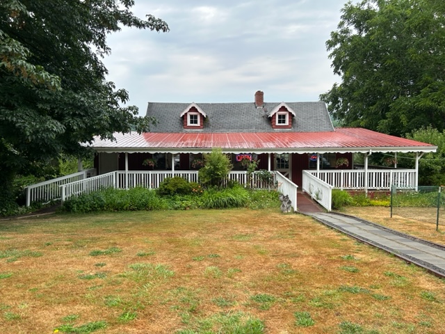
Lunch at Fire Mountain Grill
Fire Mountain Grill is perfectly placed for lunch with a great menu (try their Mountain Berry Cobbler!), about 15 minutes further east from Mt St. Helens Interpretive Center on SR-504, right along the road and on the left (watch for mile marker 19): 9440 Spirit Lake Hwy, Toutle, WA 98649. Open: daily 11-7.
Hoffstadt Creek Bridge
Road construction in the 1990s replaced the northern route to the mountain, much of which was destroyed in the eruption. The construction included 14 new bridges, including the Hoffstadt Creek Bridge as the second highest bridge in Washington State at 370 feet high. The bridge happens to sit right at the edge of the blast zone.
The bridge is about 10 miles east of Fire Mountain Grill—watch for the sign for the turn off to the left that leads to the bridge viewpoint at the west end of the bridge. Three interpretive panels inform the visitor about the forest at the furthest reach of the blast zone and about the bridge’s construction.

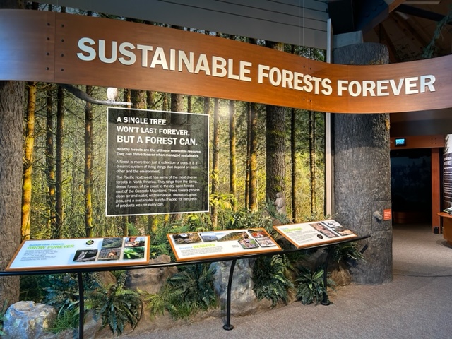
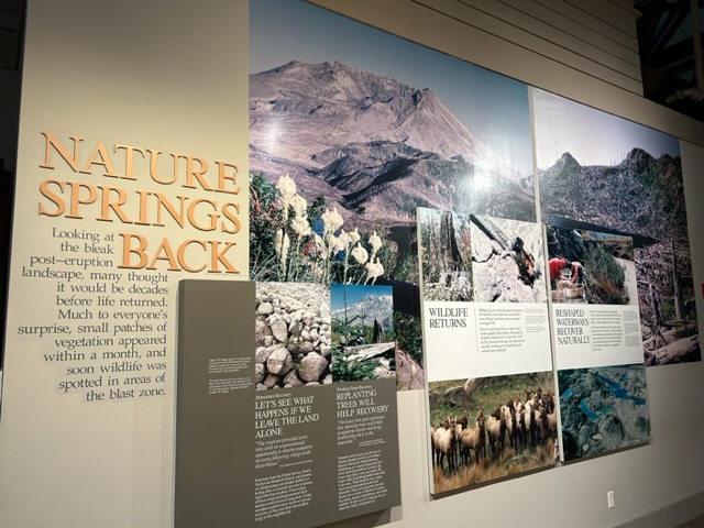
Mt St. Helens Forest Learning Center
The visitor center is owned and operated by Weyerhaeuser, a wood products company that has owned and managed much of the forests around Mt St. Helens since 1900. On that fateful day in May 1980, 68,000 acres of Weyerhaeuser forest was devastated. Come learn of that devastation, but also come and marvel at the inspiring efforts of Weyerhaeuser in its recovery program. You will also learn about the company’s long-sighted forest management. This was a super visit—if you’ve visited before it’s time to come again, as their exhibits were refreshed in 2020. There is also a 1-mile trail through forest that has been replanted since the eruption; if you are mobility challenged, you may want to limit your hike to the ¼-mile paved interpretive loop. Plan one hour for your visit, another 15 to 30 minutes if you hike the trail.
Here are details you will need, including the address to enter into your navigation app:
Mt St Helens Forest Learning Center: 17000 Spirit Lake Hwy, Toutle, WA 98649. Open: daily 10-4, mid-May-Sep. Admission: Free. Gift shop on site.


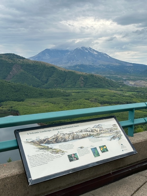
Viewpoints
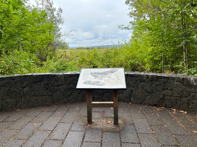
There are two viewpoints you can stop at as you approach the mountain: Elk Rock Viewpoint near mile post 37 and Castle Lake Viewpoint near mile post 40. The latter viewpoint includes three interpretive panels, making it the the viewpoint to stop at if you only stop at one.
Mt St. Helens Science and Learning Center at Coldwater
This facility is open to the public as a visitor center for the 2023 season due to the landslide that has the Johnston Ridge Observatory unreachable. Exhibits are limited though the movie is worth the visit all by itself. There are two trails accessible from the Learning Center; if you are mobility challenged you may still want to stroll the Winds of Change ¼-mile paved path through a part of the blast zone, which includes several interpretive panels. Plan 45 minutes to one hour for your visit, 15 more minutes if you walk the path.
Here are details you will need, including the address to enter into your navigation app:
Mt St. Helens Science and Learning Center at Coldwater: 19000 Spirit Lake Hwy, Toutle, WA 98649, 360-274-2131. Open: daily 10-4, mid-May-Oct; Sat-Sun 10-4 Nov-Apr. Admission: Free. Gift shop on site. NOTE: gates are locked at 4:00 p.m.

Johnston Ridge Observatory
NOTE: JOHNSTON RIDGE OBSERVATORY TO REMAIN UNREACHABLE FOR 2023 SEASON DUE TO SIGNIFICANT LANDSLIDE.
The observatory is placed almost at the base of the volcano and in the heart of the blast zone. The breathtaking view of the eruption-scarred mountain is as good as it gets without taking to a trail. Exhibits tell the environmental, geologic, and human story of the eruption and include a movie presentation. You can also walk a 0.5 mile trail to learn more details about the eruption. Plan one to 1.25 hours for your visit.
Here are details you will need, including the address to enter into your navigation app:
Johnston Ridge Observatory: 24000 Spirit Lake Hwy, Toutle, WA 98649, 360-274-2140. Admission: 16+ $8. America the Beautiful Pass accepted. Gift shop on site.

PHOTO BY JMKDOUGLAS. SOURCE: WIKIPEDIA.ORG
Accommodations
We recommend taking accommodations in Woodland, south of the mountain along I-5, as this will place you within an hour’s drive of the Ape Cave Interpretive Site. Plan early and acquire accommodation well in advance as the few hotels/motels fill up fast.
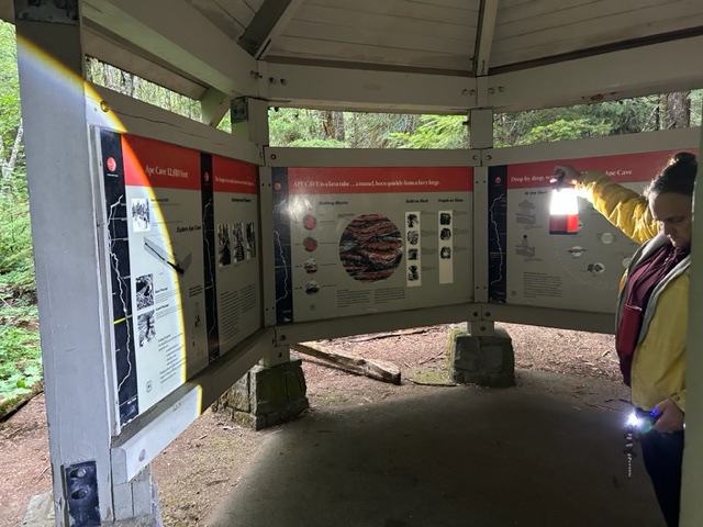
Ape Cave Interpretive Site
Day 2 is for spelunking! Ape Cave was formed roughly 2000 years ago during the only known basaltic eruption from Mt St. Helens, when fluid basaltic lava flowed down the southern flank of the volcano. As the lava flowed, the surface cooled yet insulated the molten lava beneath the surface, which allowed the formation of what is now, at 2.5 miles in length, the longest lava tube in the nation and the third longest in North America. The cave was discovered by a logger in 1947 and takes its name from a Boy Scout Troop who frequently explored the cave after its discovery.
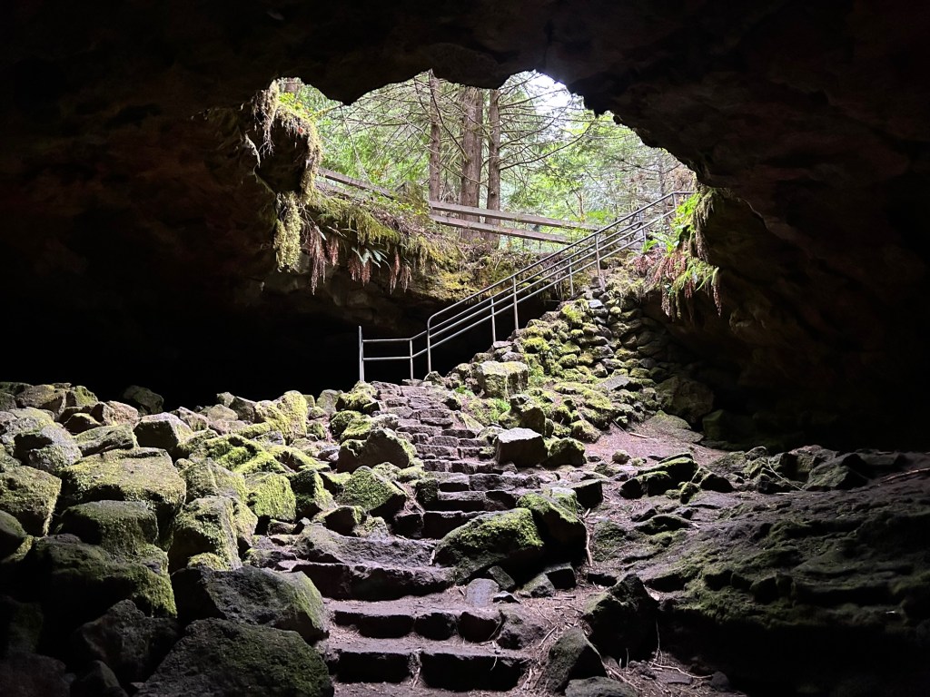
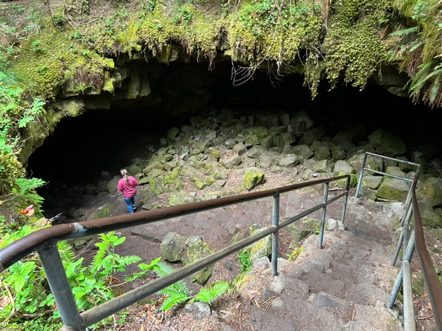
Remember to wear a jacket and good hiking shoes. Shortly after entering (entrance shown above) there are two options: a shorter, easier route that is 0.75 miles down and then back or a more difficult route that is 1.5 miles to a cave exit, after which you have the same 1.5 mile trail hike back to the parking lot. Note that even the shorter, easier route has a lot of rough, uneven footing.
Timed entry: note that parking your vehicle at the Ape Cave Interpretive Site requires a timed entry ticket, purchasable on a two-hour visit schedule with arrival required within thirty minutes of your time window; the first slot is at 9:00 a.m. and final slot at 3:00 p.m. When planning your timed entry, remember that your drive from Woodland will be close to an hour. Cost for your timed entry ticket is $2. Go to this website to purchase your timed entry ticket: https://www.recreation.gov/timed-entry/10086990
Peruse this website, as there is some good information/instruction: https://www.fs.usda.gov/recarea/giffordpinchot/recarea/?recid=40393
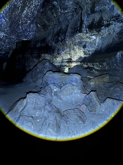
The website instructions tell you to bring two light sources per person; here is a further recommendation from us: purchase rechargeable flashlights with an output of at least 150,000 lumens. You will find that common, inexpensive flashlights won’t provide a satisfactory light source; most economy flashlights produce 1000 lumens or less!
Getting there: there is not an address to enter, but we found that Googlemaps guided us to the site by simply entering Ape Cave Interpretive Site Washington. Be sure to enter it in your app while you are in Woodland as you are likely to quickly lose internet once you are into the forested lands heading east. However, if lack of cell service leaves you feeling lost, road signs will lead you right to the site: continue on SR-504 after passing through Cougar; the road will become Forest Rd 90. About five miles past Cougar a road sign will direct you to turn left onto NF-83; about 1.5 miles will see you turning left onto NF-8303, which will lead you to the site. Open: daily 9-5, mid-May through October (see timed entry requirements above). Admission: $5 parking pass, purchasable at the office/gift shop on site or at recreation.gov site listed above (plus $2 timed entry ticket). A Northwest Forest Pass or America the Beautiful Pass also allows parking.


If you are like us, you now have a long drive home so we’ll close our itinerary with the cave. We hope you enjoyed your visit and learned some fascinating facts about the Mt St. Helens monument. Stay tuned for our next itinerary!
