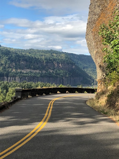
The historic Columbia River Highway was constructed from 1913 to 1922 as the nation’s first scenic highway; the Columbia River Gorge is also the nation’s second National Scenic Area, which gives you a hint of how special the byway truly is! Construction of the highway presented many engineering challenges and the roadway was considered one of the greatest engineering feats of the modern age. Come and marvel at the impressive stone masonry of the buildings, the many bridges that made the highway possible, and even the stone arches of the road guard walls that were built by Italian stone masons—and at beautiful scenic vistas dominated by numerous waterfalls that cascade from the basalt cliffs above the gorge.
Best time to visit: spring to fall, but here’s the catch: the byway and its sites are crowded to the point of often having no parking available, not only at Multnomah Falls but at each of the other waterfalls and at Vista House as well. Though the itinerary is a perfect weekend trip, we highly recommend that you begin the itinerary on Friday and plan to arrive at Vista House when it opens at 9:00 am—even better, arrive ten minutes early for parking (Vista House currently open Friday through Monday).
We suggest starting from Troutdale just east of Portland, even if coming from the east, as this allows your visit to the Multnomah Falls segment to be on Friday (and we mean early Friday morning!) rather than on Saturday.
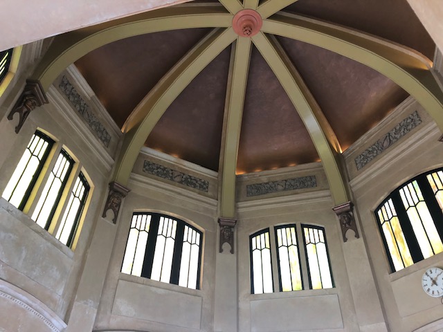
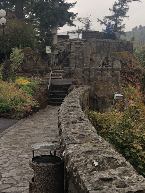
Vista House at Crown Point
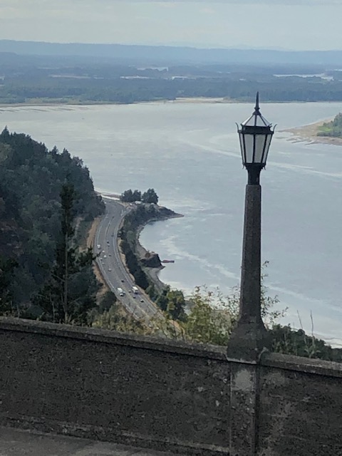
Begin the scenic drive by taking exit 18 from I-84 and heading south on Crown Point Hwy along the Sandy River. Within a short distance, the road becomes the Historic Columbia River Highway. Roughly ten miles will bring you to Vista House at the top of Crown Point overlooking the Columbia River 733 feet below.

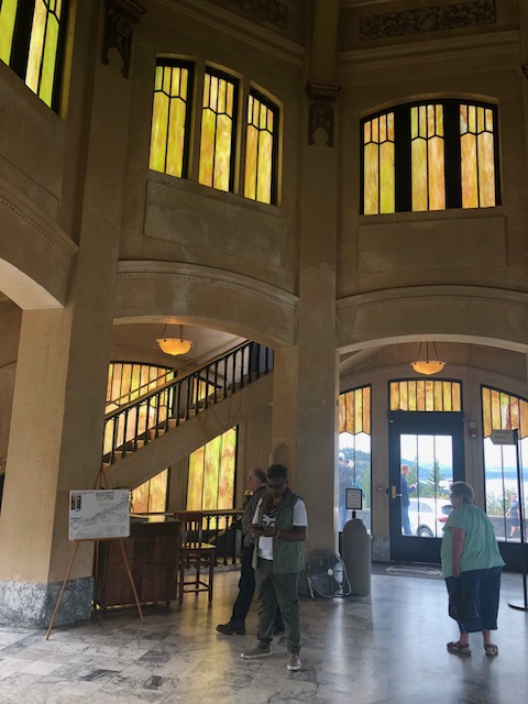
The Octagonal stone structure of gray sandstone was completed in 1918 as a comfort station along the newly completed stretch of the Columbia River Highway. The interior is finished in marble. Stairs lead to an observation platform above the rotunda and another set of stairs leads down to the basement where you will find restrooms, a small museum, and a gift shop.
Vista Point is currently open Fri-Mon 9-5.
The Waterfalls

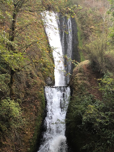
Latourell Falls: a couple of miles further east on the hwy brings you to the first of the falls. Latourell plunges 224 feet, making it the third-tallest waterfall along the highway. A short hike takes you to the base of the falls and, if you are in shape for a hike of moderate difficulty, a two-mile loop trail takes you to the Upper Latourell Falls.
Shepperd’s Dell Falls: another 1.5 miles along the hwy brings you to Shepperd’s Dell Falls. This one is definitely worth the stop. Be sure to get a view of the concrete arch bridge, which, as it turns out, offered an engineering challenge to the original builders of the road and its bridges. The bridge is on the National Register of Historic Places.
Bridal Veil Falls: another mile brings you to the falls, which are reached by a short third-mile trail. Definitely see this one.
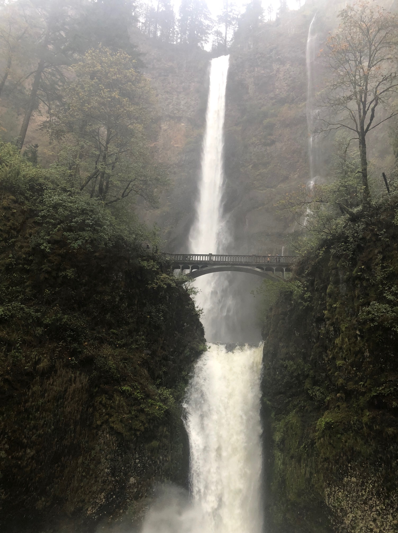
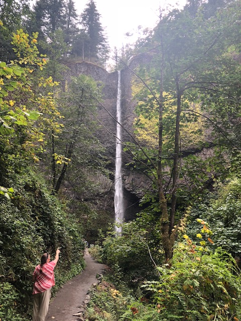
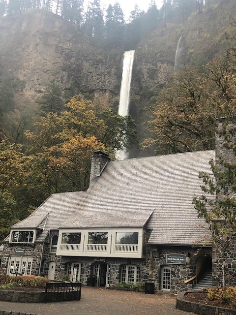
Multnomah Falls: this iconic waterfall is the crown jewel of the byway. The waterfall tumbles 635 feet in two tiers, making it the tallest waterfall in the state of Oregon. Multnomah Falls happens to be the most visited natural attraction in Oregon and was even mentioned by the Corps of Discovery as they travelled the river on their trek to the Pacific coast. The Multnomah Falls Lodge makes the site an even more impressive stop along the gorge, with a visitor center, a restaurant, and flush toilets. A short trail leads up to the Benson Bridge for a great close-up view of the falls and a much longer trail leads to the top of the falls—a rewarding view awaits at the top of the trail, but be advised that you need to be in shape for this one.
Note that the parking lot at Multnomah Falls requires a timed parking permit from a week before Memorial Day to a week after Labor Day. The permit costs $2 for a planned one hour visit, though a visit of longer than one hour is permitted. Your permit may be purchased up to two weeks in advance. To purchase your permit go to Multnomah Falls (I-84) Timed Use Permit – Recreation.gov

Bradford Island Visitor Center
Travel the Columbia River Hwy another 3.5 miles and return to I-84 east. Continue east for roughly four miles and take exit 40; turn left on NE Bonneville Wy, which will take you to the Bonneville Dam and the visitor center on Bradford Island.
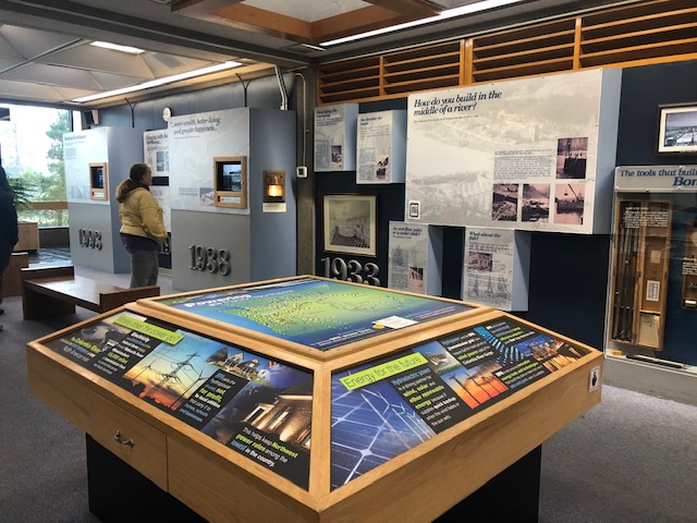
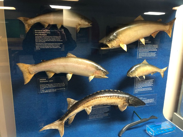
Bonneville Lock and Dam was completed in 1938 as the first federal lock and dam on the Columbia and Snake Rivers. Construction of the lock and dam provided jobs during the Great Depression. The visitor center displays exhibits about the cultural history of the region and its peoples, dam construction, the development of navigation along the river, and the life-cycles of salmon. Underwater windows allow you to watch fish as they move through the fish ladder.
Here are details you will need, including the address to enter into your navigation app:
Bradford Island Visitor Center: 541-374-8820, Star Route, Cascade Locks, OR 97014. Open: daily 9-5; closed on Thanksgiving Day and December 24 through January 1. Admission: free.
Bonneville Fish Hatchery
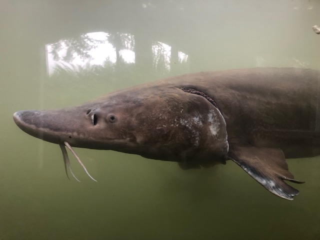
Backtrack a short distance along NE Bonneville Way to the fish hatchery, which is the largest fish hatchery in Oregon. View the display ponds and interpretive displays—and don’t miss the Sturgeon Viewing Center where you can learn about and see sturgeon measuring more than ten feet in length. Finish your visit with a stop at Spruce Gifts and Provisions.
Bonneville Hatchery: 70543 NE Herman Loop, Cascade Locks, OR 97104. Open: 7:30-dusk (gift shop open 9-7). Admission: free.
Accommodations
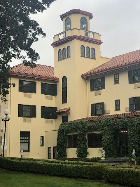
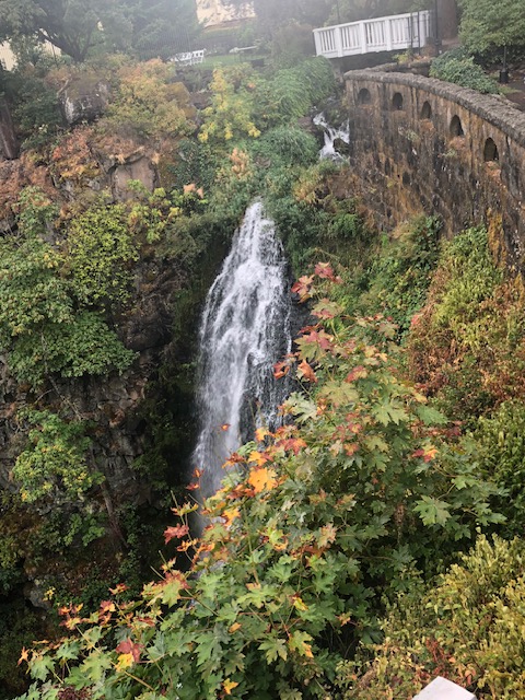
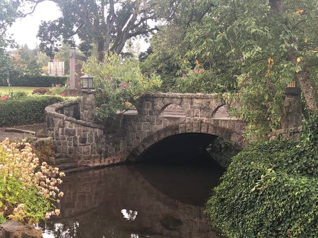
Return to I-84 east and drive 19 miles to Hood River for accommodations. Some travels reveal accommodations that truly call to the traveler, and Columbia Gorge Hotel is one such place. The hotel was completed in 1921 and includes beautiful gardens that make the hotel a must stop to walk the grounds even if you don’t take accommodations here. The tranquil gardens include extensive stone masonry, installed by the same Italian stone masons who worked on the Columbia River Highway stone work, and a waterfall that tumbles off the cliff right behind the hotel. We think you will easily spend an hour or more just strolling the gardens. Wonderful restaurants on site offer both dinner and breakfast for your delectable dining pleasure. As is often the case with boutique hotels, this one fills up fast, so plan well in advance and reserve your room early.
Columbia Gorge Hotel: 4000 Westcliff Dr, Hood River, OR 97031, 541-386-5566.
Mosier Twin Tunnels
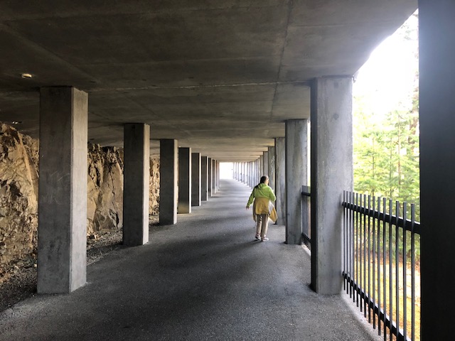
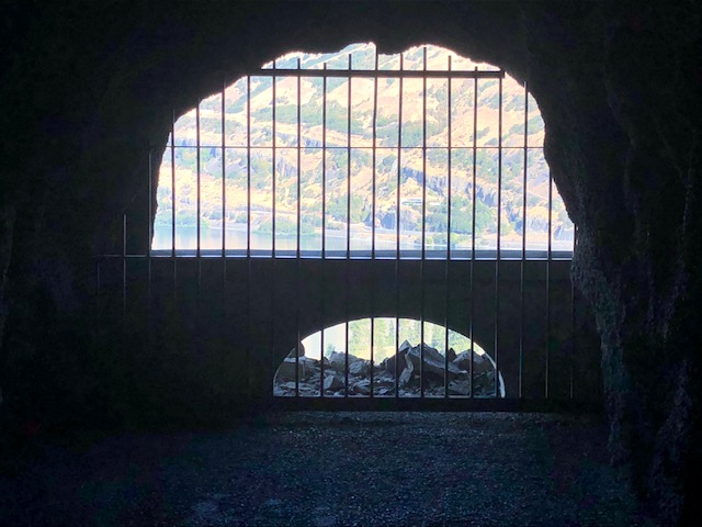
Day two starts with a hike to the Mosier Twin Tunnels. Resume your drive east on I-84 for roughly six miles; take exit 69 then turn right onto the Columbia River Highway/Hwy 30; pass over the railroad tracks and turn right onto Rock Creek Road. You will come to the trailhead parking after about a half-mile. (If you enter Mosier Twin Tunnels East Trailhead into your navigation app it will bring you to the parking lot.) The Mosier Twin Tunnels segment of the Columbia River Highway Trail is often crowded, so we suggest starting out early to ensure a parking spot. Note the a day use fee of $5 is required to park, payable on site, so be sure to have some cash on you. A hike of roughly 3/4 mile will bring you to the tunnels.
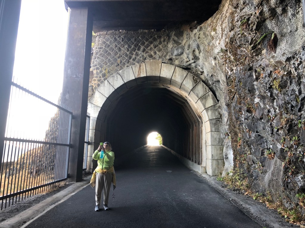
The twin tunnels were completed in 1921 when the road builders dynamited through solid basalt to create the tunnels through the cliffs above the river, which run consecutively for 390 feet. The tunnel design was inspired by the Axenstrasse, on Lake Lucerne in Switzerland. With the construction of I-84 in the 1950s, much of the old highway was abandoned and the twin tunnels were filled with stone rubble. In the 1980s the Columbia River Gorge National Scenic Area was created and the twin tunnels were given new life as part of an extensive pedestrian trail.
NOTE: Columbia River Highway State Trail currently closed between Hood River and Mosier due to wildfire. Go to Special Notices – Oregon State Parks to see current status.
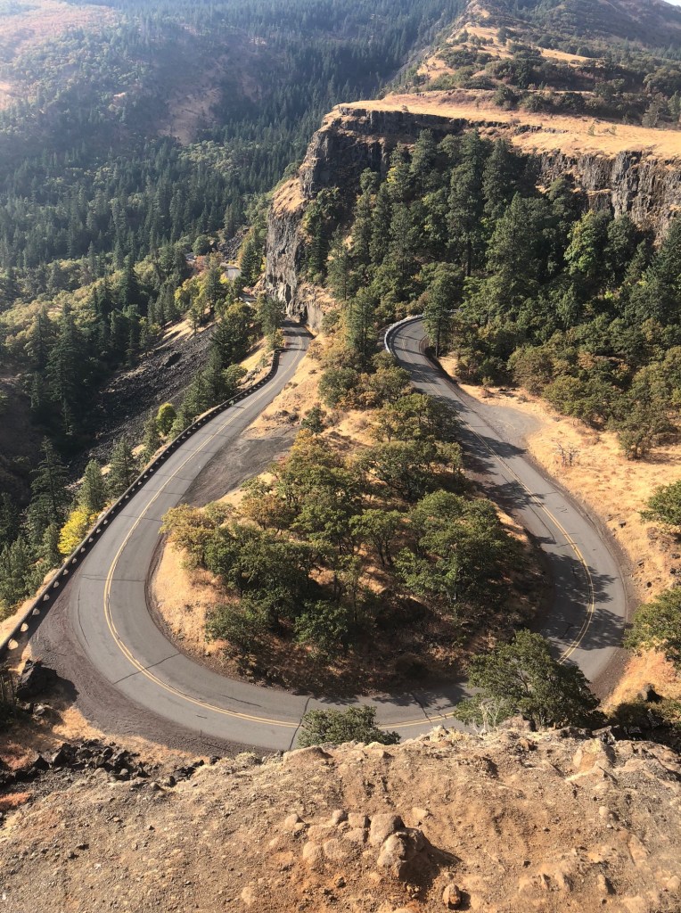
Rowena Crest Viewpoint
Return to the Columbia River Highway/Hwy 30 via Rock Creek Rd, turn right; a drive of roughly seven miles will bring you to the viewpoint atop the Rowena Crest, offering stunning views of the Columbia River Gorge below and the horseshoe shaped Rowena Loops that wind up the slopes to the viewpoint. Note: there are no restrooms at the site.
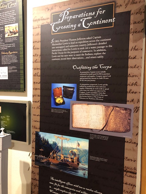
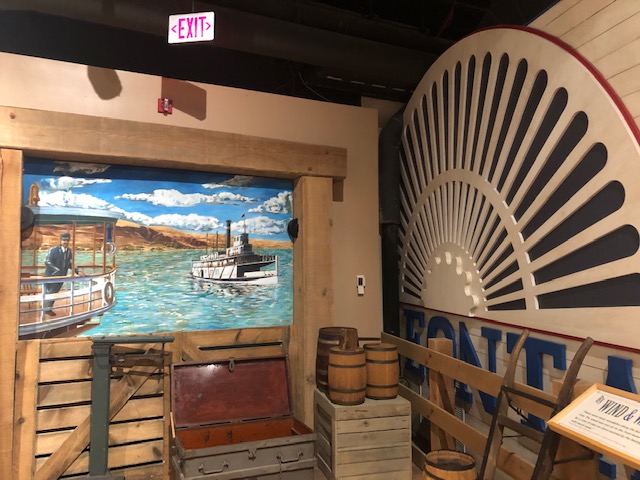
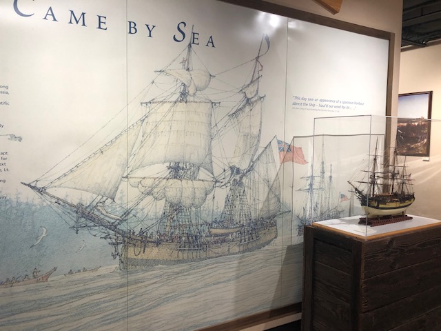
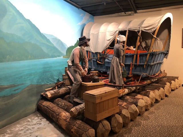
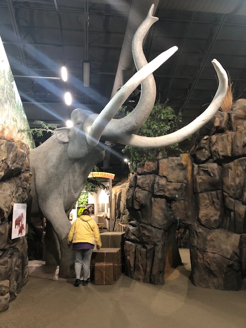
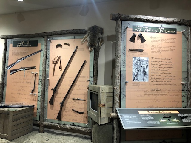
Columbia Gorge Discovery Center & Museum
Resume your eastward journey along Columbia River Highway/Hwy 30 and drive roughly six miles, turn left onto Taylor-Frantz Rd, which quickly becomes Discovery Dr and leads you to the discovery center.
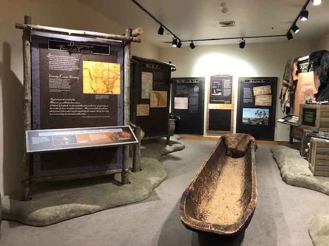
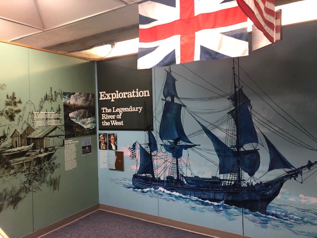
The discovery center is the official interpretive center for the Columbia River Gorge National Scenic Area and rarely will you get so much bang for your buck at a discovery center or museum! This spacial facility offers exhibits that cover indigenous peoples, the Columbia River Gorge, the Ice Age, Lewis and Clark, and Wasco County history.
Here are details you will need, including the address to enter into your navigation app:
Columbia Gorge Discovery Center & Museum: 5000 Discovery Dr, The Dalles, OR 97058, 541-296-8600. Open: daily 9-5, closed Thanksgiving, Christmas, and New Year’s Day. Admission: adult $12, 62+ $10, 6-16 $7, 5 and under free. Café and gift shop on site.
And with that our itinerary for Columbia River Gorge Scenic Highway, Oregon is complete! Please see our related itinerary, Vancouver and the Washington Side of the Columbia River Gorge. It can be viewed at https://hittheroadpnw.com/2021/06/30/vancouver-and-the-washington-side-of-the-columbia-river-gorge/?preview_id=1200&preview_nonce=82463b4b99&preview=true&_thumbnail_id=1343
